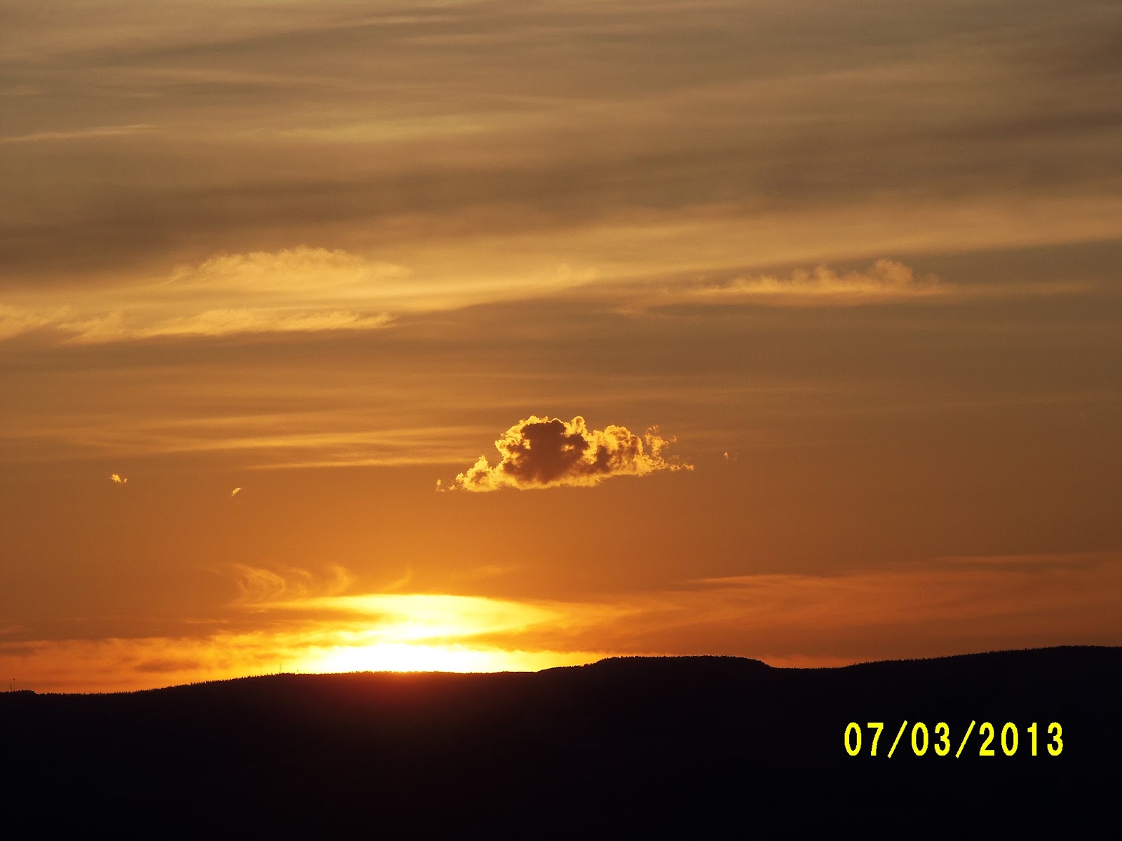
Wednesday, July 3, 2013

Utah Roadtrip: Life Elevated


One hour before sunset I sit on the porch of our log cabin in Bryce Canyon National Park. The tall ponderosa pines shade the porch as I admire the rustic structure all stone and logs with a wooden shake shingle roof that we will sleep in. Inside we can see the huge logs which support the roof. Unfortunately it will not be cool enough for us to use the fireplace.

Our elevation is almost nine thousand feet, so we will sleep with nature's air conditioning tonight. There is no television or wifi in the cabin, So after sunset, we will have a really good excuse to go to sleep.

As we drift off tonight we will have many beautiful sites to muse over. After we left our motel in Salina, we took I 70 to scenic road 24 to Capitol Reef National Park passing bluffs along the way with layers of white interspersed with deep reds. After turning on 24 we marveled at the soft brown rolling hills that looked as though they were covered with fawn suede.

We drove by corn fields, hay fields, fat cattle, and beautiful horses grazing in tall meadows as we climbed into Fish Lake National Forest. We climbed to nearly 8,000 feet, the terrain flattened, and enjoyed an area like an Alpine Meadow. By ten we were at the visitor's center having a helpful conversaation with a young ranger who hailed from Mobile, Alabama.

Some of the most spectacular red rock formations were before we even got to the visitor's center, but we also found spectacular views as we drove to Capitol Gorge where the formations were combinations of red, orange, yellow, white and grey. As we drove back to a restored Mormon settlement, the Gifford Farm, we saw the large domed white rock from which the park takes its name. It does look somewhat like the Capitol Dome.

We stopped at the Gifford House to enjoy a late morning snack of cherry pie and homemade ice cream. We also took time to pet the farm horse before continuing our scenic drive. Before we left the park we saw some more petroglyphs made by the Fremont Indians who inhabited the area centuries ago.


We headed toward Torrey to find our next scenic road, Utah12, to take us to Bryce. We stopped at Slacker’s Hamburger Shack for a really good burger and fries. The milkshakes were tempting, but we stayed strong!


Highway 12 was an adventure. It took us about three hours to drive the one hundred miles to Bryce. We passed through a lot of Dixie National Forest which is made up primarily of Ponderosa Pines and Aspens. At Larb Hollow, altitude 9,023 feet, we looked down on miles and miles of canyons, mesas, forest, and rock formations, all shades of red and orange with taller mountains behind them. This area gets twenty inches of rain a year because of the mountain ranges. As we drove along the eastern side of Boulder Mountain, we were almost ten thousand feet up. When we stopped to view the water pocket fold at Homestead Overlook light rain began to fall and the temperature dropped to 66 degrees.

As we drove through the area, ever so often we would cross a cattle guard. The cows have free range through here, so drivers have to watch for them.

As we got nearer to Bryce Canyon, we drove though areas that had steep drop offs, sometime on both sides of the road. Fortunately these stretches did not last for long.

While Klep was checking in at Bryce, I watched a chipmunk pose on one of the posts. Since then, we have seen several more.

After finding our cabin, we took the fifteen mile drive to Rainbow Point which was an excellent place to look out over the hoodoos and rock formations in this southern Utah canyon. One of the more famous is the poodle, a creamy white rock which looks very much like a poodle posing. A hoodoo is, basically a pillar of rock left by erosion. Geologists say that ten million years ago, some gigantic force within the earth pushed massive blocks that formed the plateaus that have gradually become the hoodoos. The ones at Rainbow Point remind me of dream sickles, a combination of vanilla and orange.

At Ponderosa we saw vistas of multicolored hoodoos framed by Ponderosa pines and the Table Plateau to the north. We also ran into a couple from North Carolina who shared their experiences hiking and camping overnight at Zion, our next stop. The woman was a UT grad. It is always nice to run into someone from the south. Earlier in the week I had heard a Utah talk show person (notice the restraint) who said that no one with a southern accent could be taken seriously about anything. My listening to that station was somewhat brief!

Natural Bridge was actually an arch formed by frost and wind, not water. Experts predict that it will fall; but they have no idea when.

At Farview Point, we were supposed to be able to see the plateau that formed the Grand Canyon’s north rim, but the sky was too hazy.

Back at our cabin, we sat outside enjoying the early evening until 8:30 pm when we walked to the rim to enjoy sunset, The sunset is a reflected glory because the rim of the canyon faces east. We
watched the magic light change the colors of the hoodoos as we got closer to sunset. Finally all that was left in the light was a plateau to the northeast that looked like a glowing line of Greek temples.

In the twilight we walked back to the cabin, feeling the heat of the day turn pleasantly cooler. Around ten the stars came out. Soon after my light went out.

Fifteen minutes after sunrise, I sit on the front porch of our cabin listening to the birds begin their day song in the cool, cool air. I trekked the hundred yards from our cabin to the rim at six to watch the glorious streaks of color light the sky above the dream sickle scape below, Finally after teasing for nearly twenty minutes, the huge orb broke the skyline, dashing the colors and dragging blue across the expanse. As I returned to my cabin, the little sliver of a moon was no longer visible above me.

Today we will continue with the last three view points over the canyon before dropping further down into the heat zone of Utah to enjoy the majestic splendors of Zion.

I must admit, in all fairness, that over the last couple of days, I have, at times, experienced Cathedral Syndrome. We first discovered this condition on a family vacation to Europe which included numerous trips to ancient and glorious cathedrals. When we arrived at Notre Dame, Kevin rolled his eyes, sat down, and said, “Oh no! Not another cathedral.” When this happens, we just shake our heads, clear our minds, and take another thousand photos!


Utah Roadtrip: Life Elevated

One hour before sunset I sit on the porch of our log cabin in Bryce Canyon National Park. The tall ponderosa pines shade the porch as I admire the rustic structure all stone and logs with a wooden shake shingle roof that we will sleep in. In side we can see the huge logs which support the roof. Unfortunately it will not be cool enough for us to use the fireplace.

Our elevation is almost nine thousand feet, so we will sleep with nature's air conditioning tonight. There is no television or wifi in the cabin, so after sunset, we will have a really good excuse to go to sleep.

As we drift off tonight we will have many beautiful sites to muse over. After we left our motel in Salina, we took I 70 to scenic road 24 to Capitol Reef National Park passing bluffs along the way with layers of white interspersed with deep reds. After turning on 24 we marveled at the soft brown rolling hills that looked as though they were covered with fawn suede.

We drove by Corn fields, hay fields, fat cattle, and beautiful horses grazing in tall meadows as we climbed into Fish Lake National Forest. We climbed to nearly 8,000 feet and enjoyed an area like an Alpine Meadow. By ten we were at the visitor's center having a helpful conversaation with a young ranger who hailed from Mobile, Alabama.

Some of the most spectacular red rock formations were before we even got to the visitor's center, but we also found spectacular views as we drove to Capitol Gorge where the formations were combinations of red, orange, yellow, white and grey. As we drove back to a restored Mormon settlement, The Gifford Farm we saw the large domed white rock from which the park takes its name. It does look somewhat like the Capitol Dome.

We stopped at the Gifford House to enjoy a late morning snack of cherry pie and homemade ice cream.
We also took time to pet the farm horse before continuing our scenic drive. Before we left the park we saw some more petroglyphs made by the Fremont Indians who inhabited the area centuries ago.

We headed toward Torrey to find our next scenic road, 12 to take us to Bryce. We stopped at Slacker’s Hamburger Shack for a really good burger and fries. The milkshakes were tempting, but we stayed strong!


Highway 12 was an adventure. It took us about three hours to drive the one hundred miles to Bryce. We passed through a lot of Dixie National Forest which is made up primarily of Ponderosa Pines and Aspens. At Larb Hollow, altitude 9,023 feet, we looked down on miles and miles of canyons, mesas, forest, and rock formations, all shades of red and orange with taller mountains behind them. This area gets twenty inches of rain a year because of the mountain ranges.
As we drove along the eastern side of Boulder Mountain, we were almost ten thousand feet up. When we stopped to view the water pocket fold at Homestead Overlook, light rain began to fall and the temperature dropped to 66 degrees.

As we drove through the area ever so often, we would cross a cattle guard. The cows have free range through here, so drivers have to watch for them.

As we got nearer to Bryce Canyon, we drove though areas that had steep drop offs, sometime on both sides of the road. Fortunately these stretches did not last for long.

While Klep was checking in at Bryce, I watched a chipmunk pose on one of the posts. Since then, we have seen several more.

After finding our cabin,we took the fifteen mile drive to Rainbow Point which was an excellent place to look out over the hoodoos and rock formations in this southern Utah canyon. One of the more famous is the poodle, a creamy white rock
which looks very much like a poodle posing. A hoodoo is, basically a pillar of rock left by erosion. Geologists say that ten million years ago, some gigantic force within the earth pushed massive blocks that formed the plateaus that have gradually become the hoodoos. The ones at Rainbow Point remind me of dream sickles, a combination of vanilla and orange.

At Ponderosa we saw vistas of multicolored hoodoos framed by Ponderosa pines and the Table Plateau to the north. We also ran into a couple from North Carolina who shared their experiences hiking and camping overnight at Zion, our next stop. The woman was a UT grad. It is always nice to run into someone from the south. Earlier in the week I had heard a Utah talk show person (notice the restraint) who said that no one with a southern accent could be taken seriously about anything. My listening to that station was somewhat brief!

Natural Bridge was actually an arch formed by frost and wind, not water. Experts predict that it will fall but they have no idea when.

At Farview Point, we were supposed to be able to see the plateau that formed the Grand Canyon’s north rim, but the sky was too hazy.

Back at our cabin, we sat outside enjoying the early evening until 8:30 pm. When we walked to the rim to enjoy sunset, The sunset is a reflected glory because the rim of the canyon faces east. We watched the magic light change the colors of the hoodoos as we got closer to sunset. Finally all that was left in the light was a plateau to the northeast that looked like a glowing line of Greek temples.

In the twilight we walked back to the cabin, feeling the heat of the day turn pleasant. Around ten the stars came out. Soon after my light went out.

Fifteen minutes after sunrise, I sit on the front porch of our cabin listening to the birds begin their day song in the cool, cool air. I trekked the hundred yards from our cabin to the rim at six to watch the glorious streaks of color light the sky above the dream sickle scape below, Finally after teasing for nearly twenty minutes, the huge orb broke the skyline, dashing the colors and dragging blue across the expanse. As I returned to my cabin, the little sliver of a moon was no longer visible above me.

Today we will continue with the last three view points over the canyon before dropping further down into the heat zone of Utah to enjoy the majestic splendors of Zion.

I must admit, in all fairness, that over the last couple of days, I have, at times, experienced Cathedral Syndrome. We first discovered this condition on a family vacation to Europe which included numerous trips to ancient and glorious cathedrals. When we arrived at Notre Dame, Kevin rolled his eyes, say down, and said, “Oh no! Not another cathedral.” When this happens, we just shake our heads, clear our minds, and take another thousand photos!


Tuesday, July 2, 2013

Utah Roadtrip: From North to South Central

Once we got past the sprawl of motels, fast food, and chain stores to the center of Logan, we found ourselves in a pretty little town with a viable downtown area.  It is the type place that would be nice to call home if it were a little further south.  As we angled our way back toward the interstate, we passed through other small towns, some with a decidedly Western flavor, wide valleys full of green fields of crops signs advertising fresh raspberries, beautiful lakes, horses, and cows as we traveled down to the Salt Lake Valley once again.  We accessed I 15 at Brigham City and moved south passing much of the territory that we had already covered.

By a little after one with the temp at 95 degrees, we were covering new territory south of Provo with wide expanses of crops in irrigated fields.  Ocassionally we were seeing orchards, horses, cows, and beehives.  All of a sudden we were amazed to see acre after acre of purple flowers.  We were passing the Young Living Lavender Farm! I have tried for years to grow
lavender and get it to bloom and here was acres of it!

About midafternoon we left the interstate and angled down to Salina, Utah where we had reservations for the night.  Since we were running ahead of schedule, we stopped at the visitor's center (a little tiny building with two seniors about our age) and got some advice on what to do the rest of the afternoon.  They suggested two sites:  Fremont Indian State Park and Museum and Cove Fort Historic Site.  They even told us about an excellent Mexican restaurant to try for dinner.

We got on I 70 and zipped the forty miles to Fremont Indian State Park where we learned that the Fremont Indians lived in the valleys along what is now I 70.  The Fremont Indians were agricultarists who lived in this area between 400 A.D. and 1300.   They ware thought to have been influenced by the Anasazi who introduced corn and pottery.  The Fremonts are known specifically for the art panels they created on the rocks which are visible to this day.  Many artifacts from their lives were discovered when construction of the interstate highway began.  The artifacts are on display in the museum and the art can be seen from various points in the park.
It is amazing that they could do the painting and the carving high up on the rocks with no modern conveniences!
 
After we left the museum, we drove down the road to Cove Fort, a historic site where the Church of Jesus Christ of the Latter Day Saints built a fort in 1867 which served as a way station, trading post, post office, telegraph office, and home to Ira Hinkley and his family.  We were greeted by Revo Robb who does volunteer work with he husband and 23 other couples at the site.  After the railways came in, there was no longer a need for the site, and the church sold it.  Nearly a hundred years later, the Hinkley family bought the site and donated it to the church to be restored and maintained as a historic site.  The fort is built of black volcanic rock and dark limestone.  The walls are a hundred feet long and eighteen feet high and are very thick.  The original doors made of pine and cedar are at the entrances of the fort.  The glass in the windows was made to match the one pane that had survived. There are twelve rooms in the fort which served many purposes. 
When we have better access to stronger wifi, I want Klep to write about all the things he learned when he toured the garden, barn, and outbuildings.
 
After we came back to Salina, we had supper at El Mexicano Restaurant where I had the best chilie rollenos that I had had in forty years.  It did not disappoint.  Tomorrow we resume our National Part Tour with Capital Reef National Park.


Sunday, June 30, 2013

Utah Roadtrip: A Sunday Drive to Idaho

After a leisurely start to our day (I did my exercise and swam while Klep slept in), we checked out of the Downtown Hampton Inn in Salt Lake City and went to Heritage Baptist Church in north SLC where we enjoyed worship with about fifty others as we listened to a sermon on Psalm 7 entitled "A Rock and A Fortress."  Following service, we found I 15 and headed to Idaho through the urban sprawl which finally ended after Ogden.  Gradually we saw some limited farmland and some old abandoned homesteads.
The settlements became further and further apart as we left Utah and entered Idaho.
We were getting a little low on gas, so we pulled off at a Sinclair station that advertised itself quite truthfully as "In the middle of nowhere."
 
As we got further into Idaho, we noticed a difference in the rock structures from what we have been seeing this last week.  The valleys also got wider and farmland became more common.  We saw beautiful fields of potatoes, corn, lentils, and alfalfa.  After we got on I 86 headed toward Pocatella, we passed American Falls Lake where the Snake River begins.  
The road along here is part of the original Oregon trail. We continued to Pocatella where we found Uncle Jim's Family Restaurant where we enjoyed a belated lunch or an early supper.  There actually is an Uncle Jim, but he wasn't there today.  Klep had a Greek Salad with hot flat bread and I had chicken souvlaki pita with a tossed salad. 
                         
We completed our triangle by heading south through the lush valleys of southern Idaho exiting the interstate and taking hwy 91 to Logan, Utah where we will spend the night. Klep stopped along the way to pick some alfalfa to show me since this is not something I am familiar with.   We have now reduced the number of states that we have not visited to one.  It is a little too far to drive to Oregon this trip.
 
One of the things I have been wondering about is the number of homeless people that were in Salt Lake City panhandling.  I really didn't expect that, but I guess this is a fact of life in every city now.  By and large, I have been impressed with how clean all the neighborhoods that we have driven through have been whether they were lower or upper socio-economic.  It also surprised us how little we saw of farmland until we got to the northeastern section of the state.  Much of the flat land in the Salt Lake Valley is taken up with urban development.  Where the land is irrigated, we have seen some beautiful alfalfa hay.  We also had never realized the amount of the state --70% -- which is taken up by federal land. 
 
Tomorrow we head south where we will resume our National Park visits.  We will just have to wait and see what we will discover along the way.


Saturday, June 29, 2013

SLC: Temple Square, State Capital, Big Cottonwood Canyon

Since Klep finished all the research he intends to do at the library yesterday, today was sort of finish up what we want to see and plan our departure tomorrow.  We started our day by driving down to Temple Square and finding free parking since it was Saturday.  The train, our usual transportation when we head to the city center was right next to where we parked.  We again, marveled
At the beautiful flowers that we found all up and down the street.  We entered Temple Square and found that a tour was getting ready to start in front of the Temple.

Three young Mormon women missionaries took us around the grounds showing us the statues and explaining their significance in their faith.  They then took us inside the tabernacle which is not a holy place on the same level as the temple where we were not allowed.  In there, we saw the eleven thousand pipe organ.


After the tour, we made a brief trip through the visitor's center, left Temple Square and crossed to the museum side of the street where we looked at a log cabin which was typical of what the first settlers used for housing.
Klep met a woman at the Family History Library whose great-great grandparents actually lived in this cabin.
 
We had been told that the view from behind the state capital looking down on the city was good, so we drove up there before heading east into the mountains.

On our way up the mountain we stopped for deli sandwiches and as we climbed, we found a shady pullout by a beautiful little mountain stream where we ate our lunch sitting outdoors and listening to the water run down the rocks.
We continued to climb until almost ten thousand feet where we decided to turn around instead of continuing up a road with no center stripe.
The wildflowers were beautiful going up and coming down.
We meandered through the southeastern section of Salt Lake City and back to the downtown Hampton Inn.  The pleasant eighty degree heat at almost ten thousand feet had risen to over a hundred again.....Of course it's a dry heat.
 

Friday, June 28, 2013

Salt Lake City: Emigration Canyon and the Great Salt Lake:

Klep headed back to the Family History Library and I had a down day in Salt Lake.  I caught up on my exercise in the pool, pushed some photos to Picasa so that we can get them printed, wrote on the blog, explored Western Nut Company across the road, and had a lovely nap.

Late afternoon we headed west to Emigration Canyon in the 104 degree late afternoon
for dinner at Ruth's Diner, a place recommended to us by a young woman working at the visitor's center at Glen Canyon Dam.  We have learned that we often have some of our best meals when we get the ideas of people who are actually from an area.  The diner is a long standing place to eat, first established eighty years ago by a rather colorful woman named Ruth who opened her first place in downtown Salt Lake City and later bought a trolley car and put it in Emigration Canyon where the diner still is.  Ruth died in 1989, but the owners continue to keep the flavor of the place and many of the foods which were Ruth's favorites.  I chose one of Ruth's dishes, having meatloaf, mashed potatoes, and grilled vegetables with a garden salad starter.  It was delicious.
After supper, we drove up the canyon a ways, turned around and headed west to the Great Salt Lake.  It was indeed a large, large lake.  It was also a fairly foul smelling place in the hundred degree temperature, so we did not tarry long to enjoy the view.  Somehow I thought it would be a lovely area much like a small ocean with a beach.  Somehow it didn't quite hit me that way.

We wandered back toward the motel through western and southern Salt Lake City which is pretty much like any other city in America with some industrial areas, houses, chain stores such as Lowe's, Target, Wal-Mart, and all the other things American.  By the time we arrived at the hotel, the temperature had dropped to a balmy 97 degrees.  Forecast is for the temp to be even higher tomorrow.

Salt Lake City: Research and Music

Since the breakfast buffet the Legacy Inn in Price advertised was a little less than interesting, we headed north on highway 6 and 89 toward Salt Lake City.  We climbed until we were well over seven thousand feet in altitude, crossing a rather impressive mountain range that was forested.  We passed ranches with beautiful horses, grasslands, and a few little towns before getting to Provo, the home of Brigham Young University.

Klep pulled into the parking lot of a place called Kneaders which advertised as a restaurant and bakery.  The aromas surrounding it told us that bread was being baked there.  We were not disappointed.  Basically, it is a fast food restaurant which features sandwiches, soups, and salads along with a wonderful selection of freshly baked pastries.  We each sampled soups:  tomato bisque for me; creamed cheese cauliflower for Klep.  Klep also had a sandwich and I had a serving of some of the best sour dough bread I've ever eaten.  We chatted with one of the workers as we were leaving and discovered this is a small Utah chain that began with the restaurant where we were in Provo and had expanded to twenty stores.  I predict that the chain will spread.  I think the food is better than Panera which generally fails to impress me.

After lunch, we headed up to where 89  joined I 15 and merged into traffic until we exited for the center part of Salt Lake City around Temple Square.  We finally found parking under the conference center and walked over to the Family History Library for an afternoon of genealogical research.  After three hours of work on the computer, in the book stacks, and on microfilm, I was no closer to finding anything else about my great-great grandfather and grandmother Brown than I had been.  I had some very nice help, but I left somewhat frustrated.

We checked into the downtown Hampton Inn, enjoyed a rest, got some information about the rail system, and walked to the station nearest our hotel for a ride back to the city center.  We had dinner at the Blue Lemon which serves delicious food.  Klep enjoyed salmon on rice with veggies and a really good oriental sauce.  I chose the braised short ribs with carrots and roasted new potatoes.

After dinner we strolled over to the Conference Center where we enjoyed listening to the Mormon Tabernacle Choir rehearse.  Even though it was a rehearsal with starts and stops, it was an absolute joy to hear them sing along with the 60 plus piece orchestra which accompanies them.  Some of their selections were for their upcoming Independence Day concert:
  America the Beautiful, This Land is My Land, Shenandoah, 76 Trombones.

By the time we exited the rehearsal and walked back on the western side of Temple Square under the soaring sycamore trees to our train station, the temperature had started cooling some  which was nice.  We rode our little train the three stops to the Courthouse and walked the last three blocks to the Hampton.  The sun was just setting when we closed our drapes and fell into bed.